Dorset is world-renowned for its geological diversity, as exemplified by UNESCO World Heritage Coast (‘Jurassic Coast‘) status.
As first outlined in the early 1800s by William ‘Strata’ Smith, geology underpins the varied landscape of Dorset. Ridges and uplands are formed from resilient sandstone, limestone and chalk (a pure form of limestone) with valleys and lowlands formed from less resilient sands and clays. Although our modern geological understanding is more detailed and complex, it has broadly confirmed William Smith’s pioneering work. Many geological names remain the same as those used by William Smith, often based on older quarrying terms.
christchurch_tauntonGeological section of Dorset by William ‘Strata’ Smith 1819. Zoom in for more detail. [View/Download]
| William Smith 1819 | Current Geological Nomenclature | Building Stone | ||||
|---|---|---|---|---|---|---|
| 1 | London Clay | Barton Group | Becton Sand Formation | |||
| Chama Sand Formation | ||||||
| Barton Clay Formation | Hengistbury Head Ironstone | |||||
| Bracklesham Group | Bosconbe Sand Formation | |||||
| Branksome Sand Formation | Heathstone | |||||
| Poole Formation | Heathstone and Sarsens | |||||
| Thames Group | London Clay Formation | Lytchett Matravers Sandstone | ||||
| 2 | Clay, Brickearth, Sand and Gravel | Harwich Formation | Warmwell Farm Heathstone | |||
| 3 | Crag | Lambeth Group | Reading Formation | West Park Farm Heathstone | ||
| 4 | Sand | Upnor Formation | Sarsens | |||
| 5 | Chalk | Upper Chalk | White Chalk Subgroup | Portsdown Chalk Formation | Flint and Clunch | |
| Culver Chalk Formation | Spetisbury Chalk Member | |||||
| Tarrant Chalk Member | ||||||
| Newhaven Chalk Formation | ||||||
| Seaford Chalk Formation | ||||||
| Lewes Nodular Chalk Formation | ||||||
| New Pit Chalk Formation | ||||||
| Holywell Nodular Chalk Formation | ||||||
| Lower Chalk | Grey Chalk Subgroup | Beer Head Limestone Formation | Zig Zag Chalk Formation | Beer Stone, Clunch | ||
| West Melbury Marly Chalk Formation | Melbury Sandstone | |||||
| 6 | Greensand | Selborne Group | Upper Greensand Formation | Bindon Sandstone and Whitecliff Chert Members, Eggardon Grit and Boyne Hollow Chert Members | Bindon Sandstone, Chert | |
| Foxmould Member, Shaftesbury Sandstone and Cann Sand Members | Shaftesbury Stone, ‘Cowstones’ | |||||
| 7 | Golt Brickearth | Gault Formation | ||||
| 8 | Sand | Lower Greensand Group | ||||
| Wealden Group | Course Quartz Grit | |||||
| 9 | Purbeck Stone | Purbeck Group | Durlston Formation | Peveril Point Member | Purbeck Marble, and Burr | |
| Stair Hole Member | Laning Vein, Freestone Vein, and Downs Vein | |||||
| Lulworth Formation | Worbarrow Tout Member | New Vein | ||||
| Ridgeway Member | Cypris Freestone | |||||
| Mupe Member | ||||||
| Portland Rock | Portland Group | Portland Stone Formation | Portland Freestone Member | Portland Freestone | ||
| Portland Chert Member | Chert | |||||
| 10 | Sand | Portland Sand Formation | Gad Cliff Member | |||
| Pondfield Member | ||||||
| Corton Hill Member | ‘Exogyra Bed’ White Cementstone | |||||
| Black Nore Member | ||||||
| 11 | Oaktree Clay | Kimmeridge Clay Formation | Upper Kimmeridge Clay | Dolomitic Limestone | ||
| Lower Kimmeridge Clay | Dolomitic Limestone | |||||
| 12 | Coral Rag and Pisolite or Oolite | Corallian Group | Abbotsbury Ironstone Formation | Ironstone | ||
| Sandsfoot Formation | ||||||
| Clavellata Formation | Clavellata Stone | |||||
| Osmington Oolite Formation | Stour Formation | Abbotsbury, Todber, Marnhull, Sturminster and Cucklington Stone | ||||
| 13 | Sand | Redcliff Formation | Hazelbury Bryan Formation | |||
| 14 | Clunch Clay and Shale | Oxford Clay Formation | Weymouth Member | |||
| Stewartby Member | ||||||
| Peterborough Member | ||||||
| 15 | Kellaways Stone | Kellaways Formation | ||||
| 16 | Cornbrash | Great Oolite Group | Cornbrash Formation | Upper Cornbrash Member | Cornbrash | |
| Lower Cornbrash Member | ||||||
| 17 | Clay & Sand | Forest Marble Formation | Forest Marble Sandstone | |||
| 18 | Forest Marble | Forest Marble Limestone | ||||
| 19 | Clay over the Upper Oolite | Frome Clay Formation | ||||
| 20 | Upper Oolite | Wattonensis Beds Member | ||||
| Clay | Fuller’s Earth Formation | Upper Fuller’s Earth Member | ||||
| 21 | Fuller’s Earth Rock Member | Fuller’s Earth Rock Member | Fuller’s Earth Rock | |||
| Clay | Lower Fuller’s Earth Member | |||||
| 22 | Under Oolite | Inferior Oolite Group | Burton, Beaminster, Sherborne and Hadspen Stone | |||
| 23 | Sand & Sandstone | Lias Group | Bridport Sand Formation | Ham Hill Limestone Member | Ham Hill Stone | |
| Doggers | ||||||
| Down Cliff Clay Member | ||||||
| 24 | Marlstone | Beacon Limestone Formation | Eype Mouth Limestone Member | Symondsbury and Yeovil Stone | ||
| Marlstone Member | ||||||
| 25 | Blue Marl | Dyrham Formation | Thorncombe Sand Member | Doggers | ||
| Down Cliff Sand Member | ||||||
| Eype Clay Member | ||||||
| Charmouth Mudstone Formation | Green Ammonite Member | |||||
| Belemnite Marl Member | Belemnite Stone | |||||
| Black Ven Marl Member | ||||||
| Shales-with-Beef Member | ||||||
| 26 | Lias | Blue Lias | Blue Lias Formation | Blue Lias | ||
| 27 | White Lias | Penarth Group | Lilstock Formation | Langport Member | White Lias | |
| Cotham Member | ||||||
| Westbury Formation | ||||||
| 28 | Red Marl | Mercia Mudstone Group | ||||
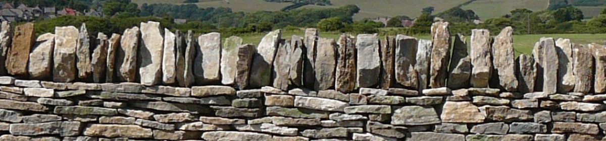
This geodiversity is reflected in the varied and localised use of stone in dry stone walls and other buildings. Every town, village, hamlet, estate and farm has typically been built from stone from local quarries. Even places only a few miles apart can be built from very different stone that defines their particular character, atmosphere and charm. For more information see Jo Thomas (2008) Dorset Stone, Dovecote Press, Dorset or the Dorset Building Stone website.
In and around the county a wide range of building stone has been used: Blue Lias (Lyme Regis, South Somerset), Beacon Limestone (Symondsbury, Yeovil), Inferior Oolite (Burton Bradstock, Mapperton, Beaminster, Sherborne), Fuller’s Earth Rock (Thornford), Forest Marble (Bridport, West Bexington, Langton Herring, Yetminster, Lillington, Longburton), Corallian Limestone (Abbotsbury, Wyke Regis, Marnhull, Todber), Portland and Purbeck (Isles of Portland and Purbeck), Chert (Morcombelake), Upper Greensand (Shaftesbury), Chalk and Flint (Frome, Cerne and Piddle valleys), Heathstone (Lytchett Matravers). For further geological detail, see our interactive map.
Some prestigious buildings, particularly churches, have used stone from further afield, even ‘imported’ from outside Dorset. For example many church door and window frames use Ham Hill Stone, from just over the border in South Somerset. Such ‘exotic’ stone is rarely found in field walls, though there are exceptions. For example walls around Cerne Abbas may contain Purbeck Stone ‘recycled’ from the ruined Abbey and originally from quarries on the South Dorset Ridgeway.
Dorset is pockmarked with old quarry workings. Many are identified on First and Second Edition OS Maps and are often visible as scars on high resolution LiDAR Digital Terrain Models (See interactive map). The Dorset Area of Outstanding Natural Beauty is rooted in an earlier industrial landscape. However, there are now rather few working quarries which can make sourcing appropriate material for dry stone walling, and other geoconservation projects, rather difficult.
It is hoped the following resources may help you source the ‘right’ stone for a particular location. It is well worth making the effort.